Digital Collection & Media

Archive & Photo Gallery

A visual and sound immersion among the faces of the tonnarotti, ancient archive papers, coastal maps and historic songs.

Digitization in progress

The historic images shown come from public domain archives (Wikimedia Commons and Archive.org). Authentic photographs and documents from the Gallipoli tuna fishery will be published as the archive digitization proceeds.

Photo Library

Faces and Sea Labor

Click an image to enlarge it full screen. The historic photographs come from public domain archives; authentic Gallipoli tuna fishery images will be added as digitization progresses.

Provenance: Eugenio Interguglielmi (1904) — museum photographic fund. Licence: public domain (CC0). Preservation: WebP digital copies, originals held in the archive.
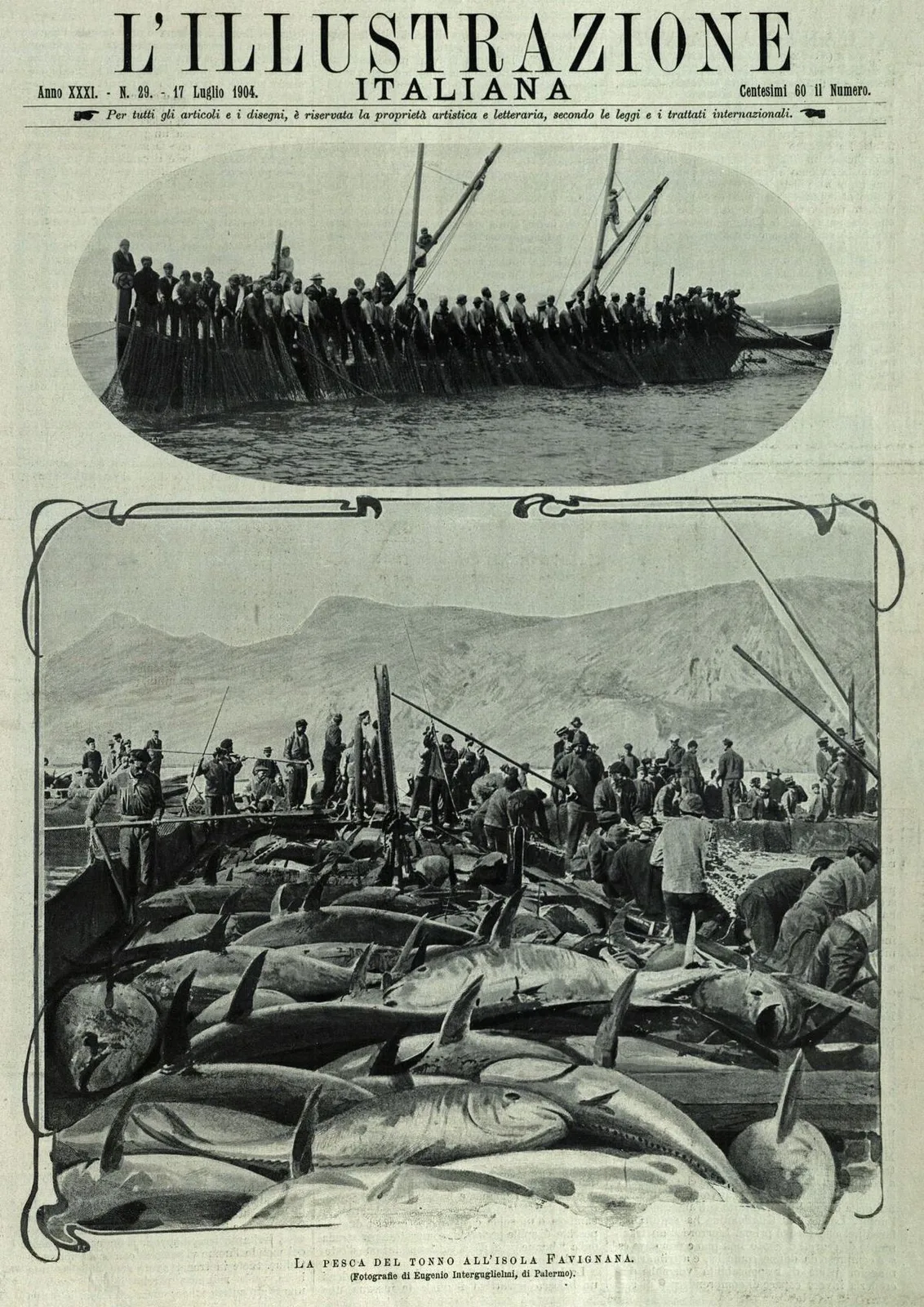
Historic 1904 photo: tuna fishing with nets
Historic Photo • 1904

Tuna Fishing (1904)

Tonnarotti at work among the nets in a 1904 photograph by Eugenio Interguglielmi.
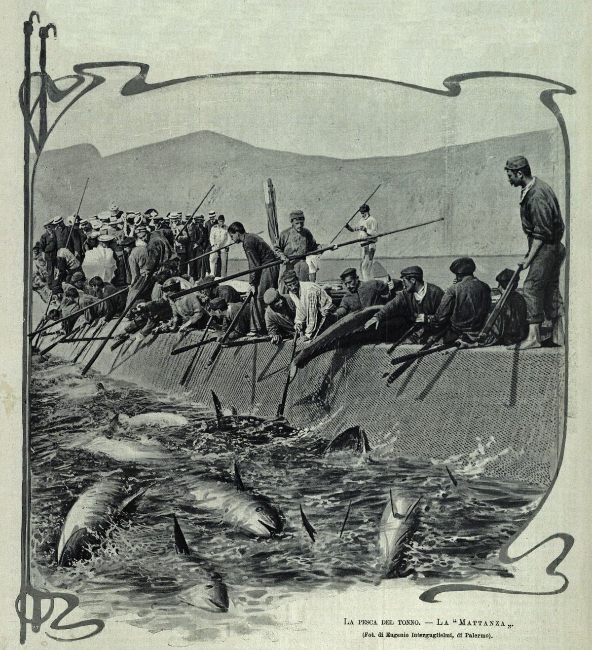
Historic 1904 photo: the tuna mattanza
Historic Photo • 1904

The Mattanza (1904)

The culminating moment of the fishing ritual, photographed by Interguglielmi in 1904.
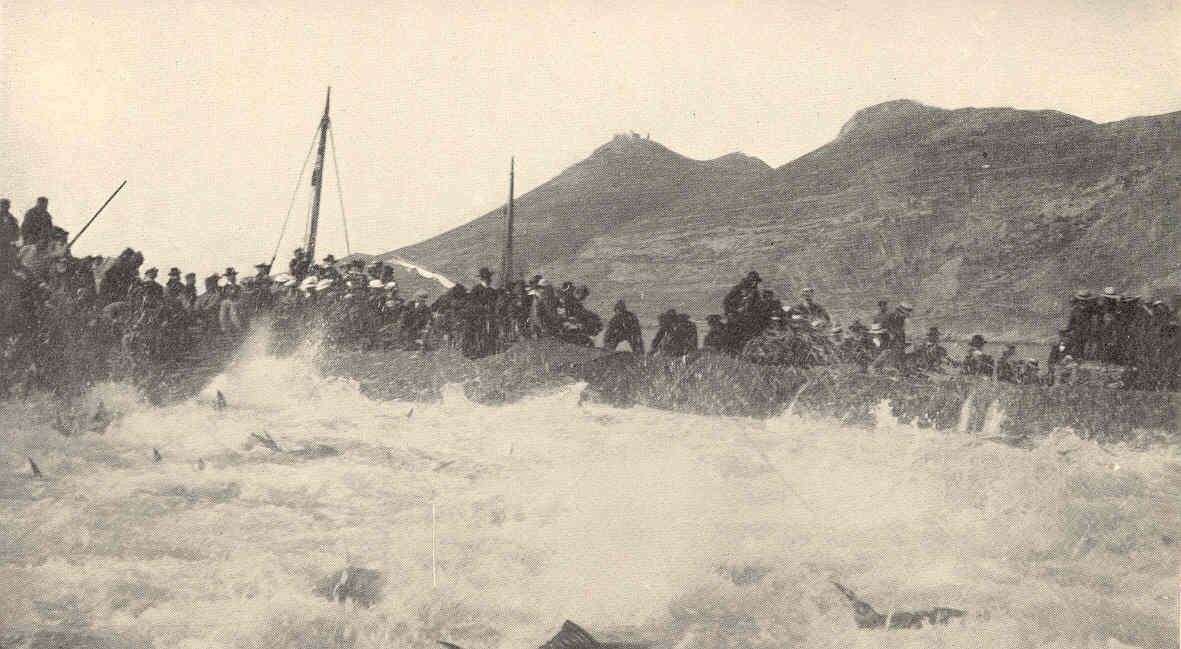
Historic 1909 engraving: fishing boats among the nets
Engraving • 1909

Boats at Work (1909)

1909 engraving (Charles F. Holder): work vessels and net handling.

Tricarico Collection

Tricarico Photo Gallery

Historic photos and documents from the Tricarico collection, digitized for the tonnara's visual heritage.
Archive Sources

Maps, Royal Decrees and Registers

The oldest documents speak of transfers of papers, the Red Book and the loss of entire file bundles. Visitors to this collection find traces of an archive that almost disappeared and a memory that demands protection.

“The entire pre-unification archive that was stored in the Garibaldi theater was sold by the Municipality to a junk dealer..."

Source: Gallipoli_Archivio_delle_scritture_antic.pdf

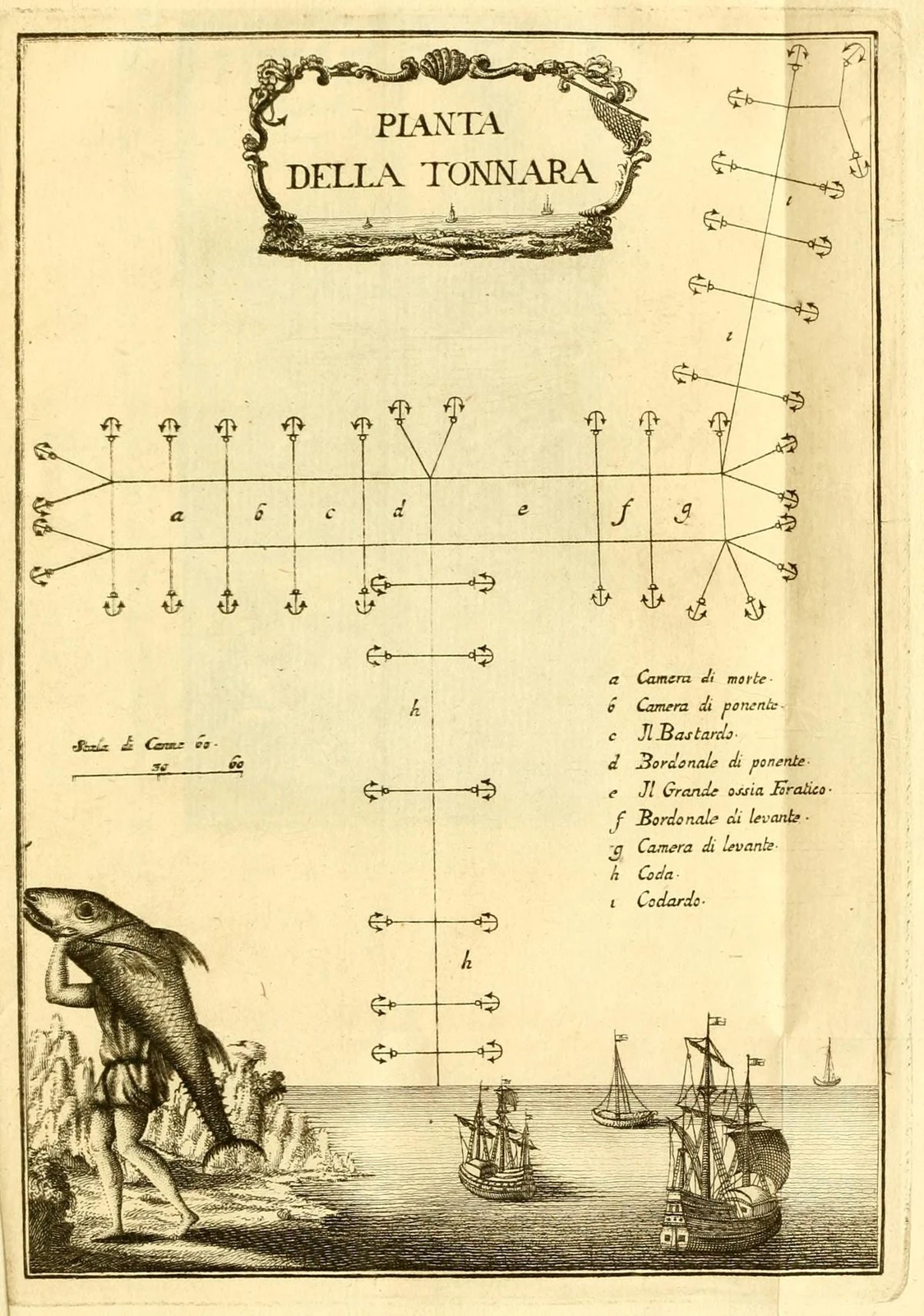
Historic 1777 plan of a fixed tonnara Historic Document

Historic Plan of a Fixed Tonnara (1777)

From Francesco Cetti's Anfibi e pesci di Sardegna (1777): the geometry of the pedal and chambers that formed the tonnara's fixed structure.

F. Cetti, Anfibi e pesci di Sardegna (1777) • Public domain
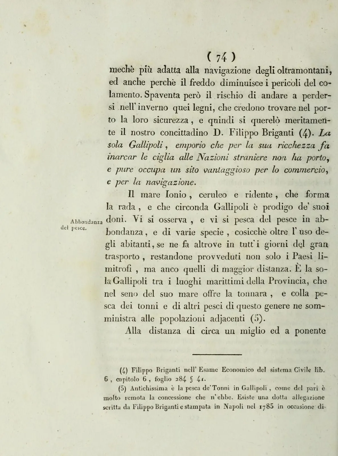
Page from Ravenna's Memorie istoriche della città di Gallipoli (1836), which mentions the tonnara

Bartolomeo Ravenna, Memorie istoriche della città di Gallipoli (1836), p. 106

Historical Memories of the City of Gallipoli (1836)

The page where Bartolomeo Ravenna recalls that "Gallipoli is the only maritime place in the province that offers the tonnara within its sea."

B. Ravenna, Gallipoli (1836) • Public domain
Historical Cartography

The Routes of the Tuna and the Harbours of the Gulf

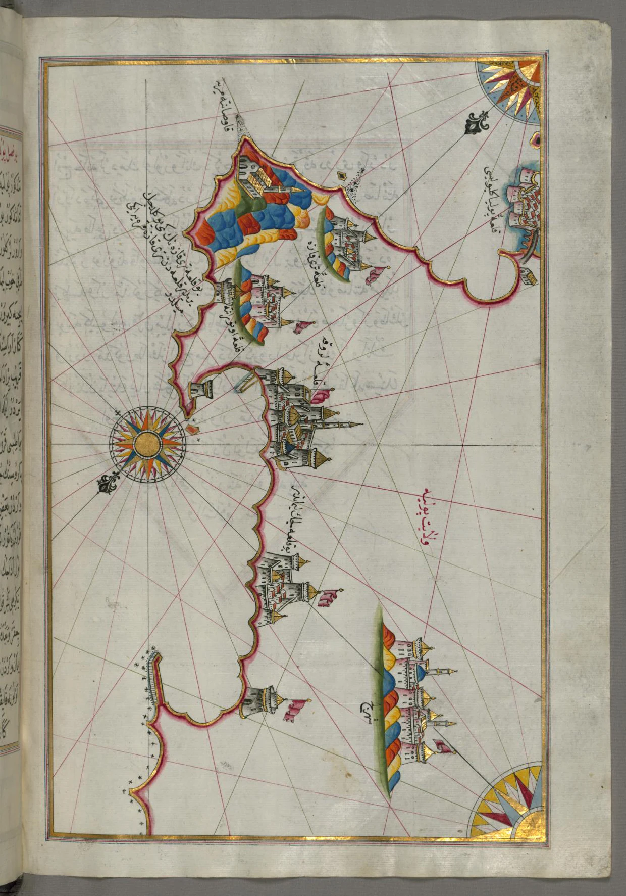
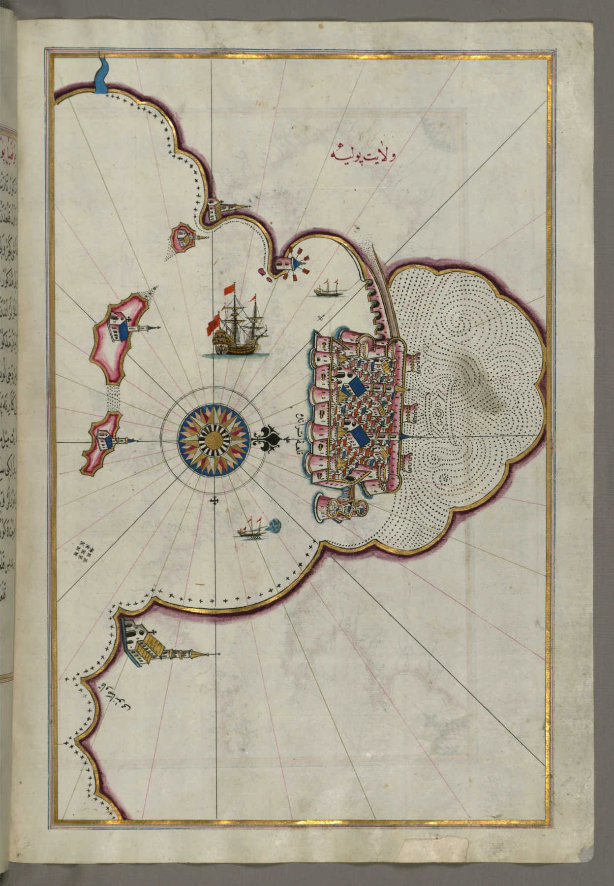
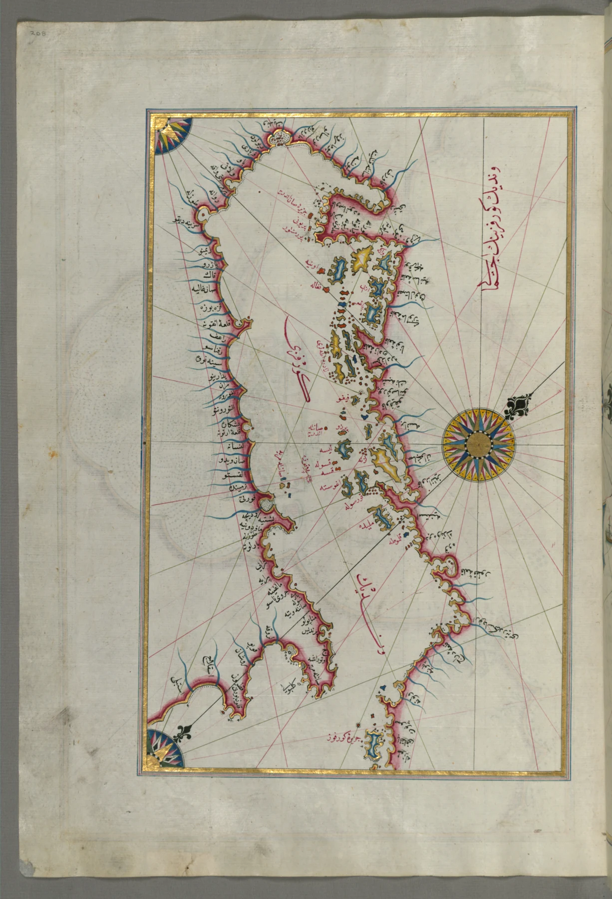
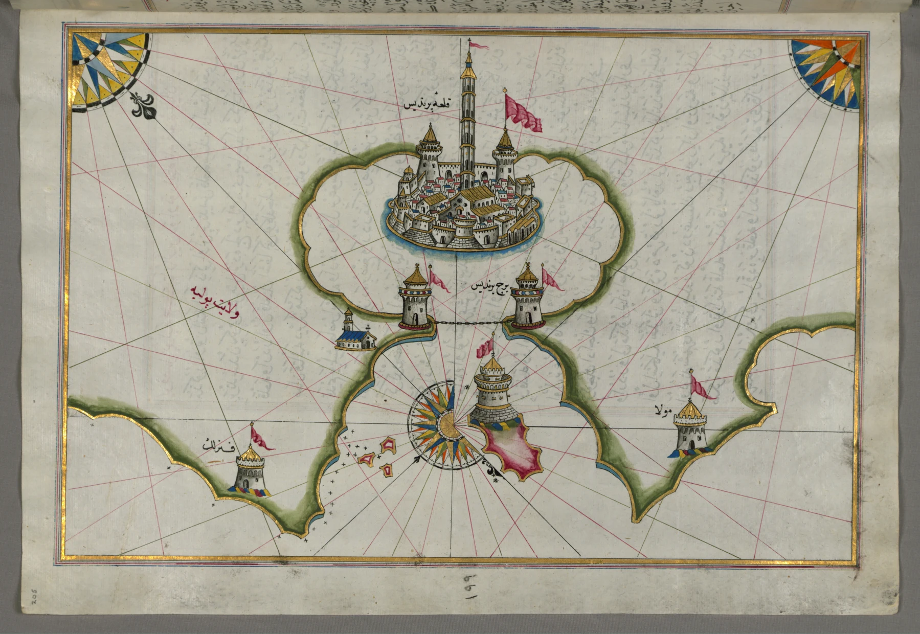
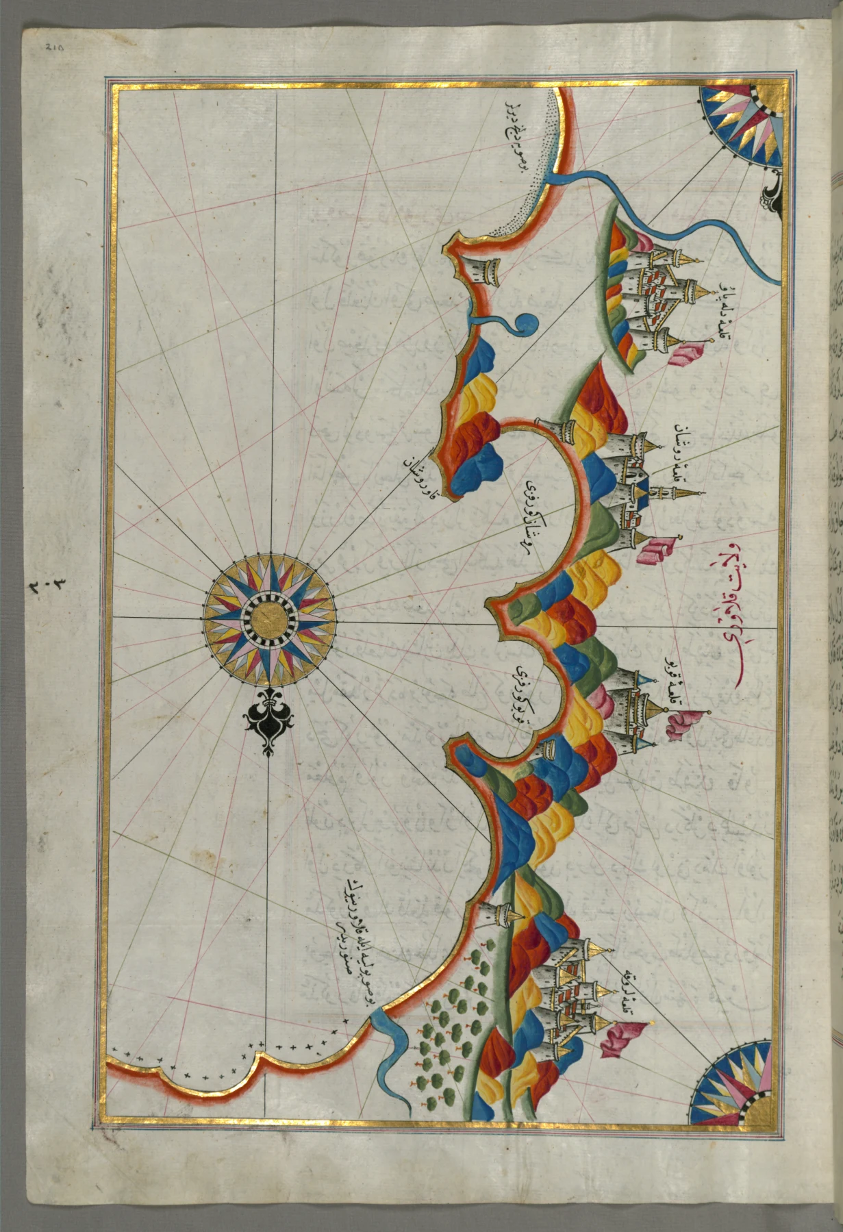
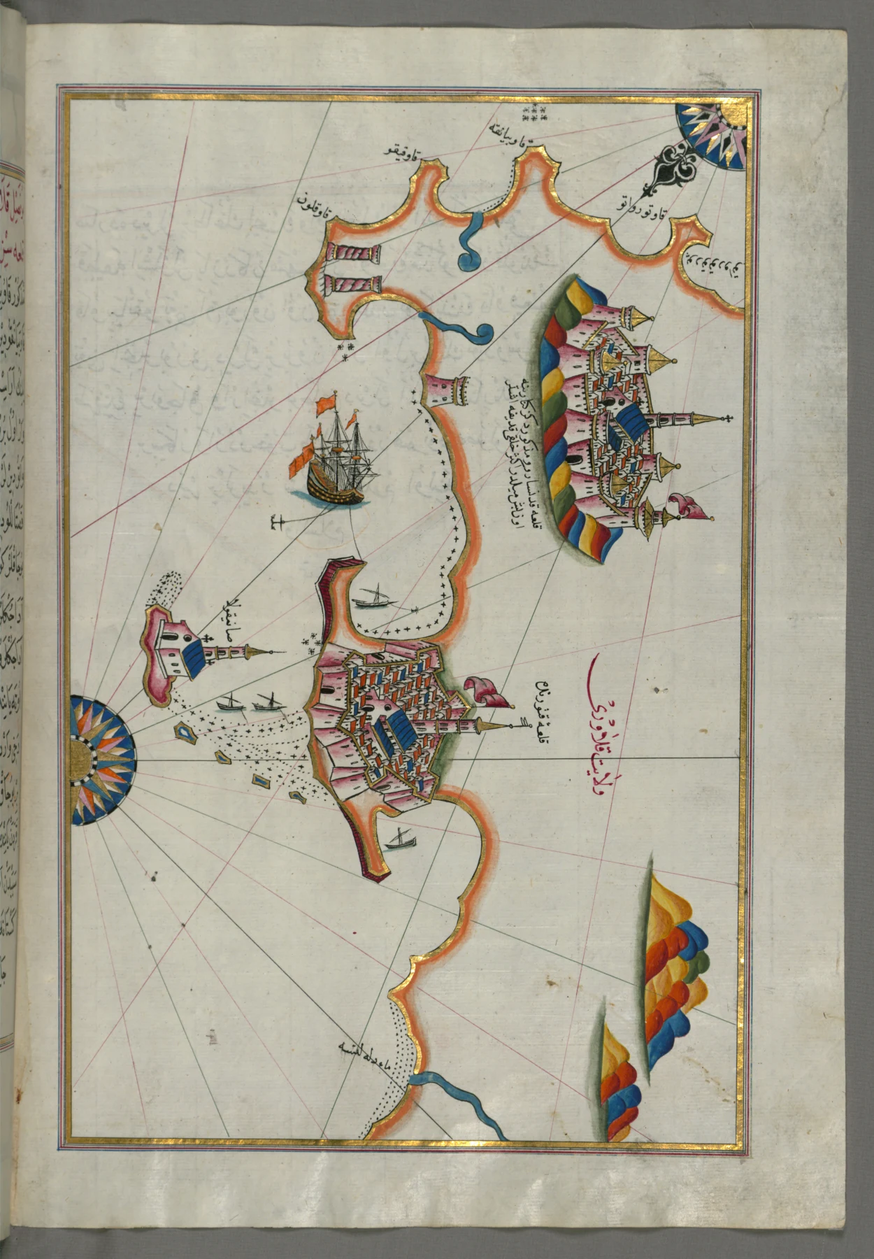
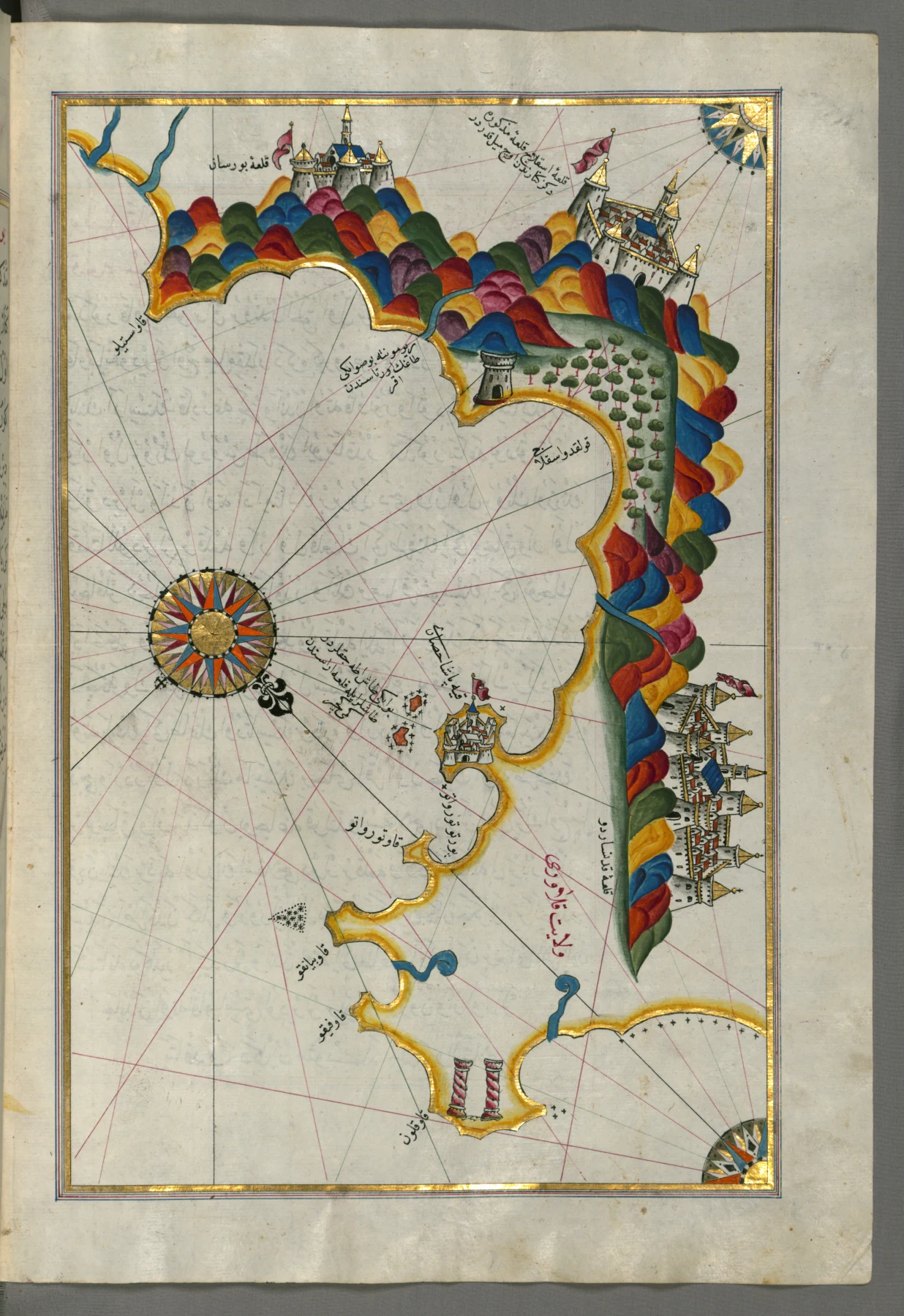
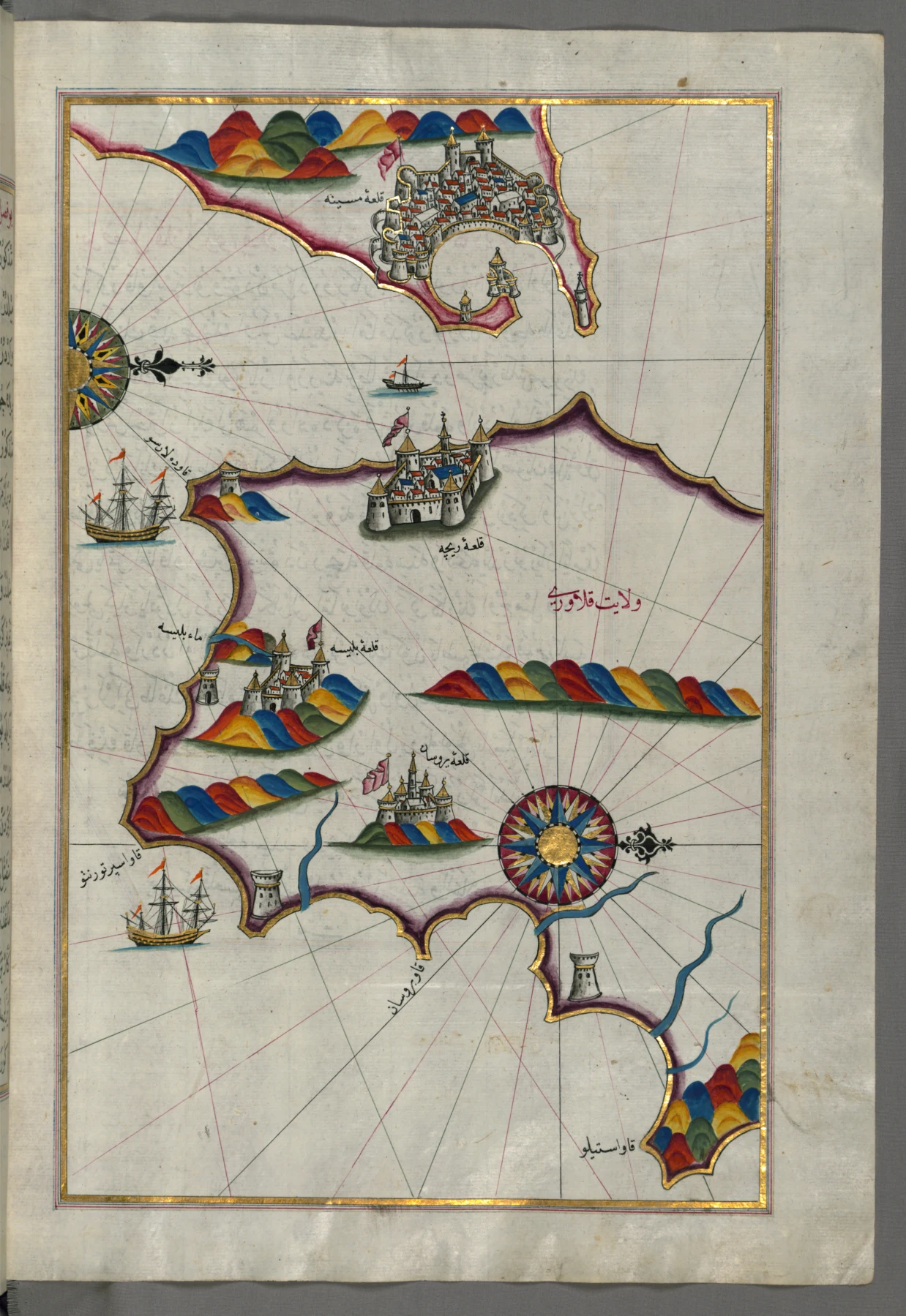
From the Kitab-ı Bahriye (Book of Navigation) by Piri Reis, the Ottoman admiral and cartographer: the charts portraying the coast of Salento, the Gulf of Taranto and the Mediterranean at the time when the tonnara of Gallipoli was among the richest in the Kingdom.

Source: Piri Reis, Kitab-ı Bahriye, Walters Art Museum manuscript W.658 (Baltimore) • Public domain (CC0)

Piri Reis chart of the Italian coast from Lecce to Gallipoli
Piri Reis • 16th c.

The Coast from Lecce to Gallipoli

The Ionian coast of Salento from Lecce to Gallipoli, with the gulf that hosted the tonnara.

Kitab-ı Bahriye, f. 206b • W.658.206B
Piri Reis chart of the city of Taranto
Piri Reis • 16th c.

The City of Taranto

The northern edge of the Gulf of Taranto, north of the Gallipoli coast.

Kitab-ı Bahriye, f. 208b • W.658.208B
Piri Reis chart of the coasts and islands of the Adriatic
Piri Reis • 16th c.

Coasts and Islands of the Adriatic

The Adriatic coast and its islands: the opposite side of the Salento peninsula.

Kitab-ı Bahriye, f. 208a • W.658.208A
Piri Reis chart of the port of Brindisi
Piri Reis • 16th c.

The Port of Brindisi

The port of Brindisi (Parindis), historic Adriatic harbour north of Gallipoli.

Kitab-ı Bahriye, f. 205a • W.658.205A
Piri Reis chart of the eastern coast of Calabria near Rossano
Piri Reis • 16th c.

The Eastern Coast of Calabria (Rossano)

The Ionian coast of Calabria near Rossano: the opposite side of the Gulf of Taranto.

Kitab-ı Bahriye, f. 210a • W.658.210A
Piri Reis chart of the eastern coast of Calabria with Crotone and Catanzaro
Piri Reis • 16th c.

Crotone and Catanzaro

Crotone and Catanzaro on the eastern coast of Calabria, along the tuna routes.

Kitab-ı Bahriye, f. 211b • W.658.211B
Piri Reis chart of the Calabrian coast from Catanzaro to Squillace
Piri Reis • 16th c.

From Catanzaro to Squillace

The stretch of Calabrian coast from Catanzaro to Squillace, on the Gulf of Taranto.

Kitab-ı Bahriye, f. 212b • W.658.212B
Piri Reis chart of southern Calabria and the Strait of Messina
Piri Reis • 16th c.

Southern Calabria and the Strait of Messina

The southern edge of Calabria and the Strait of Messina, at the southern limit of the gulf.

Kitab-ı Bahriye, f. 213b • W.658.213B
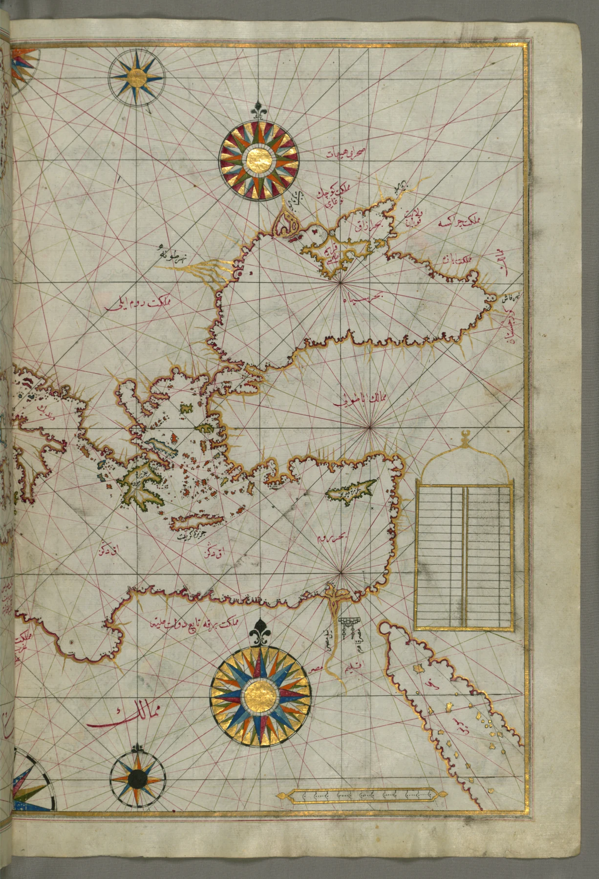
Piri Reis chart of the eastern Mediterranean, the Aegean Sea and the Black Sea
Piri Reis • 16th c.

Eastern Mediterranean, Aegean and Black Sea

An overview of the eastern Mediterranean, the Aegean Sea and the Black Sea.

Kitab-ı Bahriye, f. 63b • W.658.63B
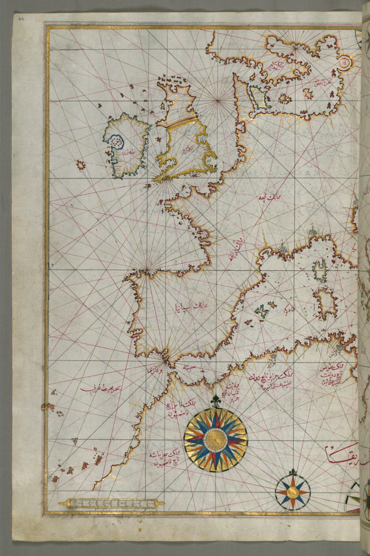
Piri Reis chart of Western Europe and North Africa
Piri Reis • 16th c.

Western Europe and North Africa

Western Europe and North Africa in a single navigational chart.

Kitab-ı Bahriye, f. 64a • W.658.64A
Archive Inventory

Non-digitised materials

The original documentary nucleus is available for consultation on site. Below is the descriptive inventory of the series and registers: an initial working tool for scholars.

Item Content Period Condition Access
Red Book I Royal privileges and concessions of the University (municipality) of Gallipoli, including the charter of Charles V (1526) on the monopoly of the waters. 16th c. Good (restoration ongoing) On site
Red Book II Continuation of the register: concessions, duties and municipal resolutions concerning the jurisdictional waters. 16th–17th c. Fair On site
"Tonnara Comunale" fascicles Documentary series on the administration and concession of the municipal tonnara. 19th c. Fragmentary On site
Archive transfer record (1833) Record drawn up by the chancellor Carlo Mazzarella, signed by the mayor Francesco Pasca, on the transfer of the municipality's ancient archive. 1833 Digitised PDF ↓

The definitive archival shelf marks will be published following the cataloguing work. For consultation, use the contact form for researchers.

Audio Archive

Voices of the Sea: Cialome

The rhythmic songs used by tonnarotti to pace their bare-handed effort on the nets.

Cialoma del Ritirato: "Aiamola"

Historic ethno-musical recording • Voice of the Rais and crew

Audio coming soon

The recording will be available once the archive audio digitization is complete.